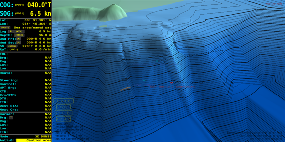
The ability to support dived navigation is a particular strength within the ECPINS software. Featuring the ability to display dived overlays, AML data, and other unique submarine chart products, combined with 4-dimensional waterspace management tools, the operator can comprehensively prepare the waterspace to meet their operational requirements.
In combination with bathymetric fixing techniques, 3D viewer, and pool of errors navigation, the software presents an extremely powerful combination of charting tools, navigation features, and waterspace management functions.
The submarine dived navigation space is the most demanding and challenging environment for naval operations.
Whether it be inshore reconnaissance, open ocean patrol or under the ice operations, OSI’s Tactical Dived Navigation System (TDNS) is specifically designed with the intent to overcome the challenges of the underwater battle space and increase submarine safety and tactical capability.

OSI has been delivering ECPINS systems into ships and submarines operating in the polar regions for more than 20 years.
OSI’s ECPINS is a fully certified WECDIS that functions as a key enabler to surfaced and dived navigation, providing both the user interface with the integrated system, and optimising the practice of safe navigation for vessels operating in challenging environments.
Polar Navigation