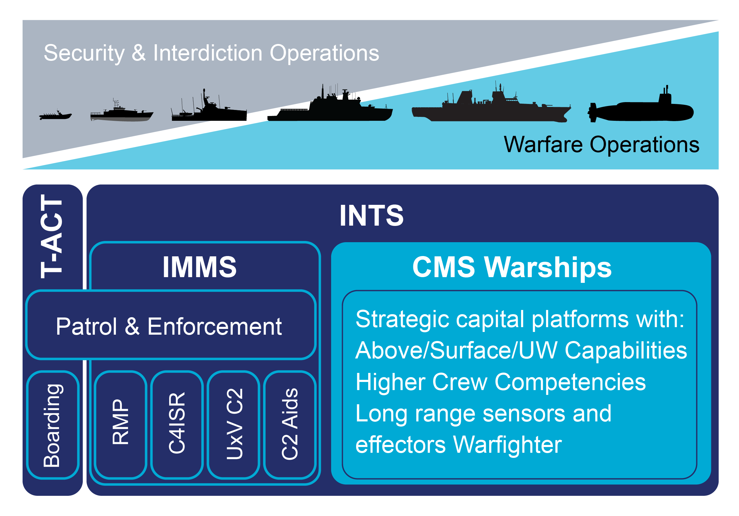
IMMS
Integrated Mission Management System
IMMS (Integrated Mission Management System) is a Command Aid C4ISR system, bringing enhanced tactical mission support to WECDIS. Tailored for Patrol Boats, Multi-Purpose Vessels, Ocean-going Patrol Vessels and Auxiliaries executing a wide range of missions and occasionally supporting low-intensity warfare.
A comprehensive Common Operating Picture, C4ISR support, Unmanned Vehicle C2 and Mission Management, video tools and combat decision aids are capability extensions provided via integration with select partner and NATO applications in our MERIT (Mission Enhancement through Rapid Insertion Technology) environment. This includes integration with a range of sensors, information systems and data links.
-
Recognized Maritime Picture
-
Dedicated Patrol Mission functionality
-
Above Water Warfare functionality module
-
Optional Underwater Warfare functionality module
-
Warfare system integration, e.g.:
• Multiple position sources, navigation radar, (W)AIS, ADSB
• FC radar, EO, ESM, sonar, TDL
• Gun, decoy
Powered by ECPINS
- STANAG 4564 WECDIS functionality
- Military grade, proprietary chart engine
- Advanced track management
- SAR, Small Craft and Aircraft modules
- Powerful proprietary Navigation & Tactical
Data Distribution Unit (NavTacDDU) - Secure Data Exchange with OSI
Small Craft system (T-ACT)
Why IMMS?
Enhanced Situational Awareness: Build a complete Recognized Maritime Picture for informed decision-making.
Mission Planning & Execution: Plan, execute, and legally record patrol missions with ease.
Credible Enforcement & Self-Defense: Support peacetime operations, crisis response, and interdiction of illegal activities.
Flexible Integration: Seamlessly connects navigation, sensors, effectors, and communications into one coherent system.
Key Features & Benefits
Common Applications
Shared functionality with WECDIS and AIMS ISR for seamless integration
Military-Grade Chart Engine
Supports all common charts, GIS data, and imagery without third-party reliance
Flexible Architecture
Enables future sensor and effector upgrades
Third-Party Application Options
Interfaces with unmanned systems and AI tools
NATO Integration
Approved for NIRIS, JChat, ICC
Mission Review & Data Export
Comprehensive playback and data packaging for HQ analysis
Comprehensive playback and data packaging for HQ analysis
EO/IR Data Handling
Dynamic map layers, augmented reality overlays
Track Classification
Advanced behavioral analysis and auto-correlation
GNSS-Denied Operations
Maintains geospatial accuracy using novel sensor technology
Secure Data Exchange
Extends situational awareness to small craft systems