ECPINS software provides the military navigator or small craft commander with the tools needed to conduct tactical navigation in the most challenging of environments.
Whether conducting navigation warfare in GNSS denied environments (be that on the surface or sub-surface), addressing the challenges of high latitude navigation, or conducting high-speed, small craft navigation, ECPINS has the solutions necessary to maintain navigational safety and freedom of manoeuvre.
This page provides an insight to just some of the specialized areas of navigation and operations in which ECPINS excels.
Coastal Navigation
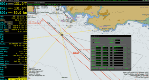
ECPINS supports all of the traditional techniques used to conduct coastal waters navigation, ensuring the ability to navigate in a GNSS denied environment. Fully aligned with the procedures and doctrine laid down in BR45, the combination of traditional methodology and ECPINS’ unique technology enables maintenance of position in even the most challenging NAVWAR scenarios.
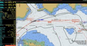
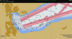
Pilotage
ECPINS features and functions support the planning and execution of pilotage and confined waters navigation, enabling full compliance with the procedures mandated in BR45, Admiralty Manual of Navigation. Software tools such as the automatic import of own ship turn data and tidal data integration significantly enhance the efficiency of pilotage planning and the safety of confined waters navigation.
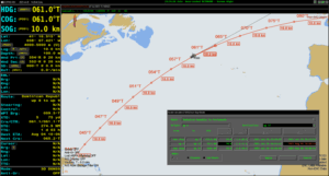
Ocean Navigation
ECPINS’ instinctive route planning tools enable the quick and efficient planning of long-distance ocean passages. With Great Circle options and the ability to subdivide legs, the operator has the ability to optimise their route plan to best allow for operational constraints.
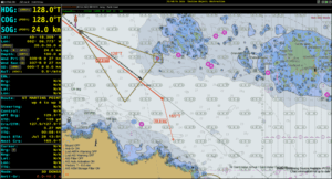
Restricted Visibility
Navigating in conditions of restricted visibility can be challenging both in terms of maintenance of real time position, as well as collision avoidance. ECPINS seamlessly fuses navigation data from a wide variety of sources in a single location, helping the operator to correlate the information, and informing risk of collision assessments and COLREGs compliant decision making.
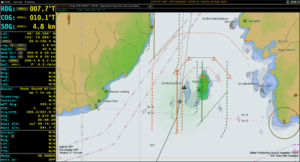
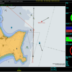
Poorly Surveyed Waters
The ability to safely navigate in poorly surveyed waters can be the difference between mission success and the loss of an operational platform. ECPINS contains tools to assess the varying quality of chart data and provides functions to delineate between safe and unsafe areas (even in conditions of GNSS denial).
Navigation Warfare
Whilst ECPINS is an IMO Type Approved ECDIS, the system is first and foremost a Warship ECDIS, meeting NATO’s STANAG 4564 Edition 2 standard. ECPINS therefore contains a wide range of features and functions designed to support tactical navigation requirements.
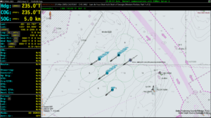
In-Company Navigation
Operating in company with other units has the potential to reduce the capacity of the bridge team and impact on their ability to conduct their core navigation duties. ECPINS tools for sector screens and grids are designed to make it easy for the Officer of the Watch to identify their allocated station and quickly identify manoeuvring requirements.
Small Craft Navigation
ECPINS-SC combines our trusted chart engine and navigation solution, with a user interface designed exclusively for the small craft operator. Customisable and simple to use, ECPINS-SC enables a small craft operator to benefit from the navigational precision and safety with which ECPINS is renowned.
Solutions Home