Common Operational Picture – Image Display Server
What is COP-IDS?
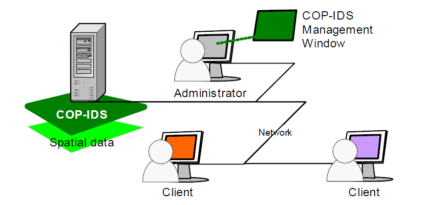
COP-IDS (Common Operational Picture – Image Display Server) is a powerful server-based application developed by OSI Maritime Systems that delivers seamless, geo-referenced images from maps, charts, and imagery to multiple client applications. It enables real-time visualization and sharing of spatial data across operational systems, providing an integrated and comprehensive view of geographic and tactical environments.
Why Choose COP-IDS?
- Rapid integration with third-party systems
- Supports legacy and modern OS environments
- Enhances decision-making through geospatial clarity
- Promotes interoperability across coalition and government systems
Use Cases
- Naval and maritime operations
- Air and ground command centers
- Intelligence and surveillance systems
- Government and security agencies
Features
Multi-Source Data Integration
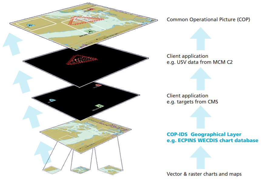
Combines vector and raster maps, satellite imagery, nautical charts, and military overlays into a single, unified display.
Real-Time Image Delivery
Efficiently serves high-fidelity images to client applications over TCP/IP, even under low bandwidth.
Customizable Client Support
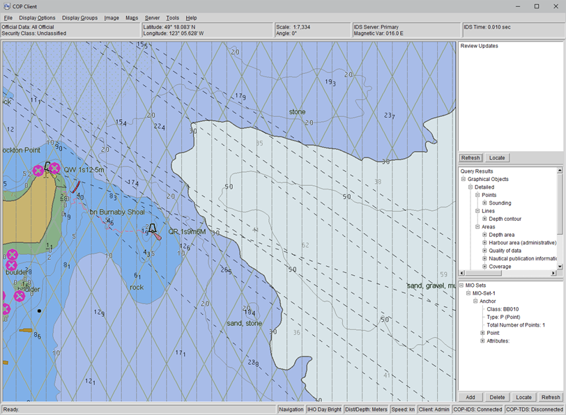
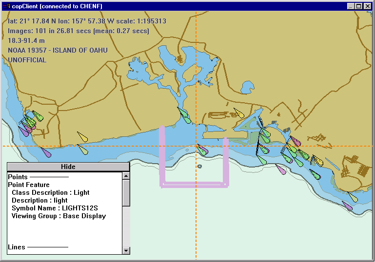
Compatible with custom applications via an open API and includes a Sample Client for quick testing and demonstration.
Scalable & Distributed Architecture
Supports multiple users and systems simultaneously, with each client operating independently.
Cross-System Compatibility
Can be embedded in legacy systems or form the backbone of new situational awareness tools.